What Is LiDAR?
LiDAR, short for Light Detection and Ranging, is a remote sensing technology that uses high-powered lasers to measure distances and create detailed 3D maps of the environment. This technology has evolved significantly since its inception in the 1960s and now plays a vital role in various industries.
LiDAR works by emitting laser pulses towards a target and measuring the time it takes for the light to return after reflecting off the object. This data helps calculate the distance between two points with high precision. The information gathered is then used to generate accurate 3D models, which are invaluable for mapping, navigation, and analysis.
 Flyability's Elios 3's LiDAR sensor glows green as it flies through a water treatment plant
Originally developed for airborne applications, LiDAR has expanded to include terrestrial, mobile, and even underwater systems. Its versatility makes it ideal for use in hazardous environments where human presence could be risky. By mounting LiDAR on drones or other platforms, it becomes an essential tool for inspections, mapping, and monitoring in challenging conditions.
What Is LiDAR?Â
LiDAR stands for Light Detection and Ranging. It is a powerful data collection technique that uses light energy—specifically lasers—to measure and map objects from a distance. This technology enables the creation of highly detailed 3D models, making it a cornerstone of modern surveying and mapping.
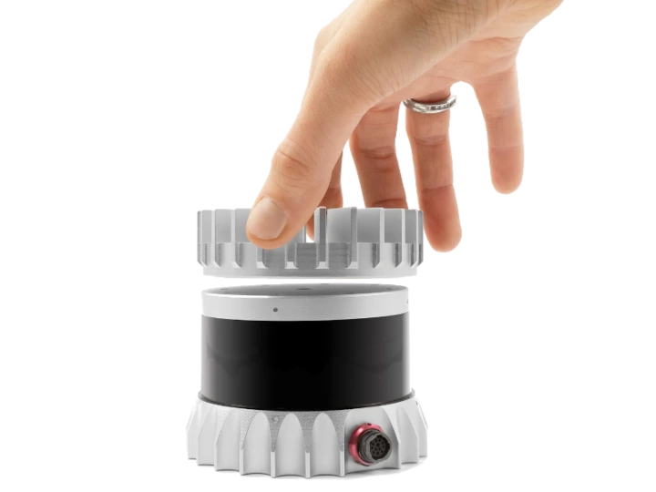
An Ouster OSO-32 LiDAR sensor
The origins of LiDAR date back to the early 1960s, when the first lasers were developed. Initially, it was a combination of "light" and "radar," without being an official acronym. Early applications focused on mapping small rivers and streams, but the integration of GPS in the 1980s revolutionized its use in large-scale geospatial data collection and topographic mapping.
Back then, LiDAR systems were bulky, expensive, and difficult to operate. They were mainly mounted on piloted aircraft, limiting their accessibility. Today, however, the technology has become more compact, affordable, and widely available. Even consumer devices like smartphones now feature LiDAR sensors, capable of creating 3D models up to 15 feet away.
LiDAR sensors along with visual sensors on a smartphone
From its early days to today’s advanced capabilities, LiDAR has come a long way. But how exactly does it work?
How Does LiDAR Work?Â
Whether mounted on a drone, plane, or handheld device, all LiDAR systems function by emitting precise laser pulses toward a target and measuring the reflected signal. This process allows the system to calculate the distance and build a detailed 3D representation of the environment.
 An infrared photo of a LiDAR sensor |Â Credit: Ouster
Similar to radar and sonar, LiDAR uses light instead of radio or sound waves to measure distances. By tracking the direction of the emitted light, the position of the scanner, and the time it takes for the signal to return, LiDAR can accurately determine the 3D coordinates of every point it scans.
Every LiDAR system consists of three main components:
1. The Laser
The laser is the core component of any LiDAR system. It emits high-intensity light pulses that travel to the target and reflect back. These pulses vary in color and intensity depending on the type of data being collected.
2. The Scanner
The scanner receives the reflected light pulses and measures them. Depending on the application, different types of lenses and optics may be used to capture the returning signals. Devices such as beam splitters or mirrors help collect and direct the reflected light.
3. Global Positioning System
A reliable positioning system is crucial for accurate measurements. Most LiDAR systems integrate GPS and other navigation tools to determine the exact location and orientation of the sensor, ensuring the data is precise and meaningful.
LiDAR Formula
The fundamental principle behind LiDAR can be expressed mathematically as:
d = c * t / 2
Where:
- d is the distance
- c is the speed of light
- t is the time of flight
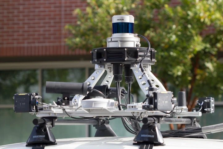
 An Ouster LiDAR sensor attached to a car
Benefits of LiDAR
LiDAR offers numerous advantages over traditional 3D modeling techniques like photogrammetry. One of its key strengths is its accuracy, allowing it to detect even the smallest details, such as individual molecules or clouds.
Another major benefit is its ability to function in low-light or dark environments. Unlike photogrammetry, which relies on visible light, LiDAR uses infrared lasers, enabling it to operate effectively in mines, tunnels, or during nighttime operations.
This capability makes LiDAR particularly valuable in safety-critical fields such as emergency response, where accurate measurements are essential for saving lives and ensuring public safety.
Additional benefits of LiDAR include:
- The ability to automate large portions of data collection
- Flexibility in collecting data from multiple sources
- Increasing affordability as the technology continues to evolve
 A LiDAR sensor mounted to a self-driving car
Types of LiDAR
LiDAR systems can be categorized based on several factors, including the type of laser used, the orientation of the system, and the platform it is mounted on.
Laser Type
One of the primary distinctions between LiDAR systems is the type of laser they use. Topographic LiDAR uses near-infrared lasers to map land features, while bathymetric LiDAR employs green light to measure underwater terrain such as seafloor depth and riverbed elevations.
Orientation
LiDAR systems can also be classified based on their orientation relative to the target. Some are oriented downward (nadir), others upward (zenith), and some are positioned laterally, as seen in many self-driving cars.
Platform
Finally, LiDAR systems are often categorized by the platform they are installed on, such as drones, aircraft, or ground vehicles. Aerial LiDAR includes drone-based, helicopter, and satellite-mounted systems, each offering unique advantages depending on the application.
LiDAR Uses and Applications
LiDAR is now used across a wide range of industries, thanks to its versatility and accuracy. Here are 12 common applications:
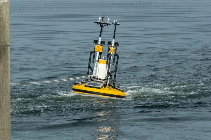
A LiDAR sensor mounted on an aquatic platform
1. Accident Scenes
LiDAR can quickly gather detailed visual data at accident sites, helping emergency services respond faster and providing accurate records for legal and insurance purposes.
2. Agriculture
LiDAR helps farmers monitor crop yields, track water levels, and manage livestock. It can even detect insects on farms, aiding in pest control and resource management.
3. Atmosphere
LiDAR is used in atmospheric studies to measure pollution, cloud structures, and gas distribution, contributing to weather forecasting and environmental research.
4. Archeology
LiDAR has been instrumental in uncovering ancient structures hidden beneath dense vegetation, such as the Mayan road systems discovered in Central America.
5. Conservation
Conservationists use LiDAR to monitor forests, wetlands, and coastal areas, helping to protect natural resources and prepare for natural disasters.
6. Inspections
Drones equipped with LiDAR can access dangerous or hard-to-reach areas, making inspections safer and more efficient for infrastructure, power lines, and construction sites.
7. Insurance
Insurance companies use LiDAR to assess damage quickly and accurately, reducing costs and improving claims processing efficiency.
8. Forestry
LiDAR provides detailed tree height and density data, aiding in forest management, conservation, and commercial forestry operations.
9. Law Enforcement
Police departments use LiDAR for speed detection, and military forces use it for surveillance and tactical planning.
10. Mining
In mining, LiDAR helps assess site safety, measure ore volumes, and identify geological fault lines.
11. Transportation
LiDAR assists in planning and managing transportation networks, from route optimization to real-time traffic adjustments.
12. Self-Driving Cars
Autonomous vehicles rely on LiDAR for obstacle detection, navigation, and parking assistance, enhancing safety and performance on the road.
Electric Car,Electric Vehicle,Electric Micro Car,Electric Car With Eec
YUMBOMOBILITY LTD , https://www.yumbomobility.com